
 |
 |
 |
 |


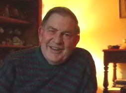
Much of it would not have been possible without the invaluable work of Philip Day,
Serving on the management Committee as scientific adviser to the Trust, Philip used his professional skill as an anlytical chemist to carry out spectroscopic, X-ray and microscopic studies in the examination of the archaeological finds.
In addition he devoted a large part of his retirement to teaching himself and many others the techniques of geophysical investigation, his last success was finding an anomaly in a Knowle Farm field, which excavtion showed to be an 18th century lime kiln.
He touched so many people with his gentle charm, bravery through his illness
and wealth of knowledge and experience which he was always ready to share.
He will be very greatly missed
 Resistivity has proved particularly successful in identifying the location and path of the outer enclosure ditch in Area B. This is largely due to the size of the feature and the high differential in resistance between the earth filled ditch and the bedrock geology. Within the area of boulder clay the difference between the natural geology and the fill of the archaeological features is less pronounced, giving less conclusive and more difficult to interpret results.
 Ground Penetrating Radar(GPR) has been used where Resistivity and Magnetometry could not be deployed, such as on the road,
drive and paved areas. One particularly interesting result leads us to believe that the northern arm of the inner enclosure may run beneath the moderndriveway of the Old Vicarage.
Ground Penetrating Radar(GPR) has been used where Resistivity and Magnetometry could not be deployed, such as on the road,
drive and paved areas. One particularly interesting result leads us to believe that the northern arm of the inner enclosure may run beneath the moderndriveway of the Old Vicarage.

Click here to link to Philip Day's website
on Geophysics activity at Mellor.
Learn more about the subject of Geophysics
