
Highlights of the 2003 Excavations
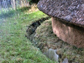
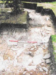
One of the aims for 2003 was to find out if the curved arc of a gully revealed in Trench 3 and in Trench 16 was the drainage channel of a Roundhouse.
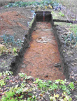
Trench 21 to the N of Trenches 3 and 16 traced a J shape round a clump of trees back to the Rhodedendron bed. Trench 23 was then opened at the other sideand enabled us to trace an almost perfect horseshoe shape around 13 meters in diameter.
Iron Age finds were identified in the gully, but also a number of Flint flakes, bringing our total to 97 Flints in a small area only 5m square.
 Specialist identification has confirmed that they are characteristic of the Mesolithic Period, suggesting that the hilltop might have been used as a seasonal camp for Mesolithic Hunter Gatherers as far back as around 5000 years ago.
 Specialist identification has confirmed that they are characteristic of the Mesolithic Period, suggesting that the hilltop might have been used as a seasonal camp for Mesolithic Hunter Gatherers as far back as around 5000 years ago.
 Trench 22 found the Eastern arm of the enclosure unexpectedly continuing straight accross to the Eastern wall rather than following the trackway. Fortunately, ploughing of the field prior to re-seeding gave opportunity for a series of nine trial trenches of stripped topsoil 1.5m wide to the East of Area B, which enabled us to pick up the continuation of the enclosure ditch running East for at least another 120 metres towards Mellor Hall.
A core sample from Trench 22 was examined by scientists from Durham University for plant microfossil and pollen assesments, who reported "The pollen indicates woodland dominated by hazel, with lime, oak, alder, birch and holly also present. Cereal type pollen (including wheat) and weed pollen suggest a mixture of arable and pastoral farming, with a waterbody and wet meadow nearby".
The Outer Ditch in Trench 18


In 2003, we were able to return to the edge of the defensive ditch which had been found at the East end of the garden in 2002 and reveal the whole of the ditch to the South and East.
Over 4m wide and on average 2m deep, the Ditch had a a parallel stone lined gully, 1.4m to the West, which may represent a slot cut to take a wooden palisade, providing a formidable defensive arrangement.
 The 5m stretch of Trench 18
 produced an abundance of finds including: Quern Stones used to grind corn,

and the Remains of 5 Roman Brooches
These were all mainly from the top two fills of the ditch, these suggest a later and deliberate back filling
and indicate that Mellor was quite probably a High Status site during the Romano British Period.
These were all mainly from the top two fills of the ditch, these suggest a later and deliberate back filling
and indicate that Mellor was quite probably a High Status site during the Romano British Period.
Trench 23 covered the short stretch beween the SW of Trench 16 and the Rhodedendron bed (which was out of bounds for excavation!) The dark grey fill of the gully could be clearly followed running into the Rhodedendrons. One of the finds here was a large notched and grooved stone, very similar to prehistoric hammer stones found on other sites.
A new interpretation
 By 2003 it seemed that we were finding sections of a deep defensive ditch roughly enclosing the Old Vicarage garden and the old part of the graveyard and a narrower and shallower outer ditch, possibly just a boundary marker but extending eastwards right up towards the top of the hill. It was thought that this might represent sections of a double ditched enclosure as illustrated to the left.
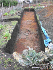
Trench 25 excavated late in the season in the bare vegetable garden showed us that the almost perfectly flat garden of today is the result of substantial landscaping. The Eastern end of the trench, near the house, has topsoil and subsoil 0.5m deep, similar to that found in other trenches in the garden. However, the natural bedrock slopes away so much that at the West end this rises to 1.2m, revealing the steep drop down from the garden to the graveyard to be an artificial construction.
It began to look like both the ditch and possibly a palisade would have run right along the contour line of the break of the slope, making the defences of the hilltop a much more visible statement of ownership to anyone approaching the settlement.


A Your Heritage Grant of £50,000 from the Heritage Lottery Fund
gave funding for another three years and with more volunteers and enabled Peter Noble and Adam Thompson from UMAU, who had previously worked as volunteers on the site, to join the summer team as supervisors.
gave funding for another three years and with more volunteers and enabled Peter Noble and Adam Thompson from UMAU, who had previously worked as volunteers on the site, to join the summer team as supervisors.

