The History of the Parish
Mellor and Ludworth (Marple Bridge) Townships, the Parish of Mellor - Three Hills and Two Valleys


The Parish of Mellor, which lies between the Rivers Goyt and the Etherow and including Marple Bridge,�comprises the ancient townships of Mellor and Ludworth.�Historical studies tell a story of scattered farms from Norman times, the coming of the textile mills at the end of the 18th century and their decline and closure in the 19th century, followed by the growth of the area as a tourist attraction and commuter community .

 For some of Britain the written record begins in Roman times 2000 years ago but for Mellor we can only reach back 800 years. The archives group led by Ann Hearle worked through and collated all the historical records which relate to the Parish, researching wide ranging sources and visiting the diffferent Record Offices in Matlock, Lichfield and London. The Project benefited from the extensive collections already held by the Marple Local History Society and personally by Ann Hearle. The team took on the task of indexing and where possible digistising these records.
 Sources have included National Archives; Lichfield Bishops' Registers; Derbyshire Record Office; Forest Records; Land Registry; Deeds and Wills; WW2 agricultural survey; Land Use surveys of 1936 and 1970, Newspapers for stories but also adverisements; the National Archives at Kew for War Memorials; Coal Mines and Coal Board Records; Water Board Records; Parish Minutes; and the list goes on...The following notes are taken from a talk given by Ann Hearle when she introduced what was known about the History of the area to the group:
 The earliest part of the Story - The Geology
The earliest part our the story belongs to the Geology, going back to 315 million years ago, when the 'Woodhead Hill' rock was laid down. The Sea and land levels rose and fell over many millions of years. This layer was eventually buried under one to two miles of later rocks, which then gradually eroded away to give our present ground level.
The Prehistory
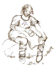
The prehistory of the area tells its story through the archaeology, our first evidence of Mankind apearing around 10,000 years ago after the end of the last Ice Age when the glaciers retreated. In Mellor Mesolithic Hunter Gatherers leave us the first traces in the form of knappings broken from cores of flint, left behind when they made their tools somewhere between 8,000 and 3,500 years ago BC.

 The next thing we find is a Flint Chisel from the Neolithic period around 5,500 to 4,000 years ago. Far too good to have just been lost it seems more likely to have beenone of those objects we find which have been misteriously but carefully placed in the ground as part of a ritual activity.
 Moving forward in time, this beautiful Flint Dagger gave us our first glimpse of the�Bronze Age at Mellor, from between 2000 and 1000 BC, although finds of a similar date had been discovered at nearly Shaw Cairn.
 Several features from the Iron Age, from around 1000 BC and 70 AD, have been uncovered at Mellor, leading into�the Romano British period, from 70 AD to 410 AD, when we start to find artefacts which indicate Roman influence and trade, if not direct evidence of occupation.
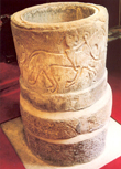
The Dark Ages of 400-100AD are aptly named at Mellor as we have little evidence of this period, other than a possibly late Anglo-Saxon stone font in the Church of St Thomas.
The Medieval Period
 In recent years we have found Medieval Pottery, postpits of an ancient structure with carbon dates from the Medieval Period and four wonderful Barbed Iron Arrowheads in the grounds of the Old Vicarage which together indicate that we have a�Medieval Aisled Hall, built in the 11th to 13th Century and remaining in use until sometime in the 15th century.
History Meets Archaeology
From this time onwards we start to have glimpses of the period through Historical Records. Our earliest record to date is an obscure Latin document dating from the 13th Century found in in the Derbyshire Record Office. When translated, it referred back to the year of 1086 with a reference to the appointment of one Roger de Melleur as Forestiere of the Peak. This remarkable piece of information forms the interface between the written History of the Parish and the Archaeology we can see in the ground from the time of our Medieval Aisled Hall. Another document mentions just �one side of a court case in the 1400s over the ownership of land in Mellor and a�document relating to Ludworth Corn Mill in the 1100's. The question is: Are there any more?


 The first known map of the area, from 1589, shows Mellor Chapel in the parish of Glossop. At that time there were just a few scattered farms, some larger houses, the church and an inn, but we begin to get Wills and Inventories from local people, Hearth Tax records and�Church Registers from the1600s. Each little piece of the puzzle gives a fuller picture of life in the Parish. The practice of assarting and Acts of Enclosure which influenced the appearance of the landscape were also mapped and recorded.
 The Industrial Age

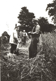
 The Industrial Age brought tremendous growth and Development to the area with the coming of the Textile Mills between 1785 - 1850. So much so that three new galleries were added to St Thomas Church to enable it to seat a congregation of 700. Form this time onwards there are a proliferation of records which include Census Returns, Local newspapers, Deeds, Maps and the first Photographs.
 The documents record both the rise in importance and population of the area but then alsoits fall in the 1850's, when�the mills became uncompetitive, closed�and the population fell. The nature of the area changed again�with the coming of the railway to Marple in 1865. Picture postcardsillustrate this as the area became part of the affluent commuter belt and a desirable escape for the residents of Manchester tothe open air of the countryside.
 And as Ann pointed out, we also need to ensure that we are leaving a complete record of our own time as part of the Mellor Heritage Project
See also:
With Thanks to Ann Hearle

